Where Is Diamond Beach in Iceland? (Map + Closest Towns)
It is not the black beach near Vík that everyone photographs on day one. Diamond Beach is far east, at the edge of Iceland's biggest glacier.
 Written with Björn Einarsson, Iceland South Coast & glacier-lagoon tour guide and local specialist
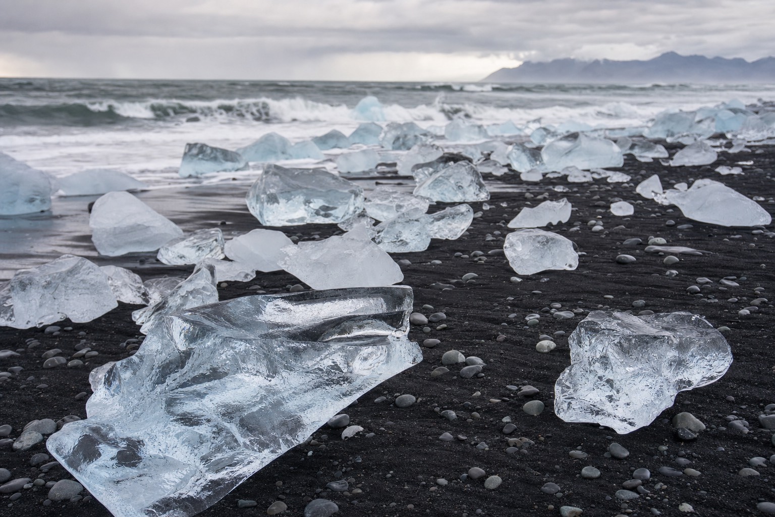
Short answer
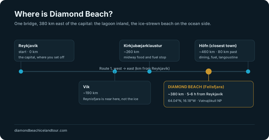
Diamond Beach is on Iceland's South-East coast, on the ocean side of the Route 1 bridge next to Jökulsárlón Glacier Lagoon. It sits about 380 km east of Reykjavík (a 5 to 6 hour drive) and roughly 80 km west of Höfn, its closest town. Its official name is Breiðamerkursandur, and the ice-strewn stretch is Fellsfjara.
People message me a photo of a black beach and ask if that is Diamond Beach. Half the time it is Reynisfjara, the famous one near Vík, three hours short of the real thing. The mistake is understandable. Iceland has more than one dramatic black shore, and the map does not make it obvious which one carries the ice. So let me put Diamond Beach exactly where it belongs before you plan a single kilometre of driving.
I guide this corner of the South-East coast, and I have stood on that black sand in every season while travellers work out, out loud, that they have driven far past every other beach to reach it. Here is where it is, what it is actually called, and how to find it without ending up at the wrong one.
Where exactly is Diamond Beach in Iceland?
Diamond Beach lies on Iceland's South-East coast, on the seaward side of the Route 1 bridge that crosses the outlet of Jökulsárlón Glacier Lagoon. It sits at roughly 64.04°N, 16.18°W, inside the municipality of Hornafjörður, at the southern edge of Vatnajökull National Park. The lagoon is on the inland side of the bridge, the beach on the ocean side.
The single most useful thing to fix in your head is the bridge. Route 1, the Ring Road, crosses a short river where the glacier lagoon empties into the sea. Stand on that bridge and Jökulsárlón spreads out behind you, full of floating icebergs, while the black beach falls away in front of you toward the surf. Same spot, two faces. The car park sits right there, so you are never hunting for the location once you reach the bridge.
This is real glacier country. Behind the lagoon rises Breiðamerkurjökull, an outlet tongue of Vatnajökull, Europe's largest ice cap by volume. The whole area belongs to Vatnajökull National Park, which is worth knowing because it shapes the rules, the parking, and the ranger presence you will meet on the ground.
What is Diamond Beach actually called?
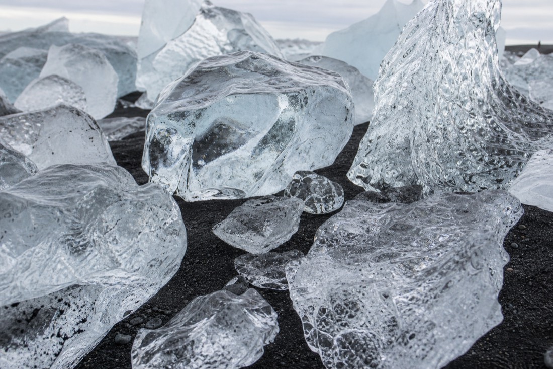
Its formal names are Breiðamerkursandur and Fellsfjara. "Diamond Beach" is a tourism nickname, coined for the way stranded chunks of clear glacier ice glitter on the black volcanic sand like scattered diamonds. Breiðamerkursandur is the wider glacial outwash plain; Fellsfjara is the specific ice-strewn stretch most people mean by Diamond Beach.
You will see all three names on maps and signs, and that trips people up. If your GPS does not recognise "Diamond Beach", search Breiðamerkursandur or Fellsfjara instead and you will land in the right place. Icelanders mostly use the real names, so a local giving directions may never say "Diamond Beach" at all.
The nickname is honest about one thing: the sparkle is genuine. Those clear lumps are old, dense glacier ice that calved off Breiðamerkurjökull, drifted across the lagoon, floated out the river mouth, then washed back onto the sand on the tide. Some of that ice is centuries old. It is not decorative gravel dumped for photos, it is the glacier arriving on the beach in slow motion, which is exactly why the spot earned a name of its own.
How far is Diamond Beach from Reykjavík and the closest towns?
Diamond Beach is about 380 km east of Reykjavík, a realistic 5 to 6 hour drive each way along Route 1. Its closest town is Höfn, roughly 80 km further east, around an hour on. Vík, the village most people pass earlier in the day, sits about 190 km back to the west, which is why day trips run so long.
Distance is the fact that decides your whole trip, so here it is laid out from the places you are most likely to start or pass through. These are moving-time figures in fair conditions, before you stop for photos, food, or weather.
| From | Distance to Diamond Beach | Typical drive |
|---|---|---|
| Reykjavík | ~380 km | 5–6 h |
| Vík | ~190 km | ~2 h 30 |
| Kirkjubæjarklaustur | ~120 km | ~1 h 35 |
| Höfn (closest town) | ~80 km | ~1 h |
| Jökulsárlón car park | across the bridge | 2 min |
Höfn is the practical base if you want more than a rushed hour at the ice. It is a small harbour town known for langoustine, and it turns a punishing there-and-back marathon into two calm days. I walk through the lodging near the lagoon and in Höfn in where to stay near Jökulsárlón, because a night out east changes the trip more than most people expect. If you are weighing the full logistics instead, the distance, the fuel, and whether a day trip is even sane, that lives in how to get to Jökulsárlón from Reykjavík.
How is Diamond Beach different from Reynisfjara?
Reynisfjara is a black-sand beach near Vík in South Iceland, famous for its basalt columns and sea stacks, about 180 km from Reykjavík. Diamond Beach is roughly 190 km further east, beside Jökulsárlón, and it is the one covered in glacier ice. They are different beaches, two to three hours apart, and only Diamond Beach has the "diamonds".
This is the single most common mix-up I correct, so it deserves its own comparison. Both are black volcanic sand, both are on the south coast, and photos of the two get swapped constantly online. But they are not near each other, and they do not offer the same thing.
| Diamond Beach (Fellsfjara) | Reynisfjara | |
|---|---|---|
| Region | South-East Iceland | South Iceland, near Vík |
| Closest town | Höfn (~80 km) | Vík (~5 km) |
| Distance from Reykjavík | ~380 km | ~180 km |
| Sits beside | Jökulsárlón glacier lagoon | Reynisdrangar sea stacks |
| What's on the sand | Clear glacier ice | Basalt columns, caves, no ice |
| National park | Vatnajökull National Park | No |
If you are trying to decide whether to bother going all the way east when Reynisfjara is so much closer, I compare them honestly, scenery, drive, danger, and all, in Diamond Beach vs Reynisfjara. Short version: they are both worth seeing, they just are not substitutes, and only one of them is three hours past the other.
How do you find Diamond Beach once you are near it?
Follow Route 1 east until you cross the Jökulsárlón bridge, then park in the marked car park right at the bridge. The lagoon is on the north, inland side; Diamond Beach is on the south, ocean side. A short signed path leads under and beside the road onto the sand. You cannot really miss it once you are at the bridge.
The geography is refreshingly simple at the end. Everything happens at one crossing. There is a main car park on the lagoon side and beach access on the seaward side, and short paths connect them. You do not need coordinates for the final approach, you need to reach the bridge, and the bridge is unmistakable because it is where the icebergs suddenly appear beside the road.
Here is the spot on a map so you can see how tight the lagoon, the bridge, and the beach really sit together, and how far east of everything else it is.
One safety note that matters at this exact location, not as scare talk but because the beach is genuinely exposed. Sneaker waves and strong rip currents run along this shore, the water is glacier-cold, and stranded icebergs can roll without warning if you climb on them. The official guidance from safetravel.is is to keep well back from the surf line and never sit on the ice. Rangers say the same on the ground. Treat the edge of the water with respect and the beach is one of the safest wonders in the country.
How do you actually get to Diamond Beach?
You reach Diamond Beach one of three ways: a guided coach day tour that handles the roughly 760 km return journey for you, a self-drive east along Route 1 in a rental, or a multi-day trip that breaks the distance with a night near Höfn. A guided coach can suit non-drivers and travellers who do not want to handle the long return drive themselves.
Because the beach is so far from the capital, how you get there matters as much as where it is. Each option trades money, time, and effort differently.
| Way to reach it | What it involves | Best for |
|---|---|---|
| Guided coach day tour | Someone drives the full ~14 h round trip | Non-drivers, winter, first-timers |
| Self-drive Route 1 | Your own rental east along the Ring Road | Confident drivers, flexible timing |
| Overnight near Höfn | Split the ~380 km, base 80 km east | Photographers, a relaxed pace |
The guided day tour dominates this particular spot for a plain reason: it is a very long way to drive on your own, and in winter the Route 1 stretch past Vík demands real confidence. Handing off that distance to a professional driver can be a practical choice if you do not want to manage the long return journey yourself. If that is you, book the guided Jökulsárlón & Diamond Beach day trip and check live availability and prices on GetYourGuide. It is a coach trip with an English-speaking guide; pickup depends on the option you book, so confirm the meeting details before checkout.
So, where is it, simply?
On Iceland's South-East coast, at the Route 1 bridge over Jökulsárlón, about 380 km and 5 to 6 hours east of Reykjavík, 80 km west of Höfn, and a long way past Reynisfjara. Search Breiðamerkursandur or Fellsfjara if "Diamond Beach" fails, park at the bridge, and the ice is on the ocean side.
The reason this question comes up so often is that the beach is genuinely far, and Iceland's coast hides more than one black shore between you and it. Once you accept that it lives out at the edge of the glacier, four or five villages beyond the famous one near Vík, the whole trip makes sense. Point yourself east, respect the distance and the surf, and the sight at the end pays back every kilometre.
Your Next Step
Match Your Jökulsárlón Plan
Initial editorial suggestion. Confirm your date and party requirements with the operator.
Have a travel date in mind? Check availability and the pickup or meeting option for the Reykjavík coach before arranging the rest of your South-East coast transport.
Ages 6+. Allow for delays. Meals are extra; glacier hiking and ice-cave visits are separate experiences.
Refine Your Choice And View Alternatives
Reykjavik: Jokulsarlon Glacier Lagoon & Diamond Beach Tour
14-hour coach trip from Reykjavík with an English-speaking guide, Jökulsárlón and Diamond Beach stops. Pickup and the seasonal boat ride depend on the booked option.
This tool compares tour formats, meeting points, listed ages, seasonal windows and duration. Seasonal guidance is not live availability. It does not confirm availability or personal suitability. Local activities do not include the drive from Reykjavík; leave extra time for travel and check-in.
Jökulsárlón: The Original Ice Cave Tour on Vatnajökull: Around 2.5–4 hours from Jökulsárlón, with an English-speaking glacier guide, modified 4x4 transport and safety equipment. Ages 10+. A cave is not guaranteed: the route may visit a blue-ice canyon, tunnel or other feature. Requires general fitness and uneven-ground walking; not suitable for mobility impairments.
Jökulsárlón Glacier Lagoon Kayaking Tour: A 1.5-hour guided paddle from the Jökulsárlón parking area, with a two-piece suit, sit-on-top kayak and equipment. English-speaking guide. Ages 14+, able to swim and comfortable in water. Not suitable for back or heart problems or those prone to seasickness. Arrive 20 minutes early; no Reykjavík transfer.